

Grant: NRDA Grant to PPBEP $2,858,000
Years: 2025-2030
Partners: Escambia County, Santa Rosa County, City of Pensacola, and the Emerald Coast Utilities Authority
What is Microbial Source Tracking?
Imagine you have a dirty swimming pool, and you know there's fecal contamination (poop!). But you don't know if it's from a dog, a person, or other source. This is where Microbial Source Tracking (MST) comes in. In simple terms, MST is like fingerprinting for bacteria. It's a set of scientific techniques used to figure out where fecal contamination in the environment (like in water) is coming from.
Here's how it generally works:
Why is this important?
Knowing the source of contamination allows for much more effective solutions. If you know the contamination is from a leaky sewer, you can fix the sewer. If it's from pet waste, you can implement strategies to encourage proper cleanup. Without MST, you only know there's contamination, but not what to do about it.
By pinpointing microbial and nutrient sources in the subbasins, this project will generate a hotspot map and a prioritized list of projects to reduce bacterial contamination
Map of subwatersheds in project area
Watersheds to be sampled:
Carpenter Creek
Bayou Chico
Bayou Marcus
Bayou Texar
Blackwater River
Blackwater Bay
Bruce Beach
Elevenmile Creek
Garcon Point
These sub basins have known impairments for bacteria and/or nutrients.
Project Overview:
Year 1: We will work with partners to compile and review existing water quality data and reports to evaluate possible sources of impairment.
Year 2: Community members will share knowledge on known impairments within their communities during engagements and workshops.
Year 3: Walk the Watershed – the project team will conduct site visits at locations identified by the community to gain a better understanding of hydrology, tributaries, infrastructure (such as sewer and stormwater), and to look for visual signs of potential bacteria sources.
Year 4: Water quality sampling will occur at identified locations.
Year 5: Data Analysis and Final Report - including nutrient and bacteria hotspot map and a prioritized list of projects to reduce bacterial sources.
Grant: EPA Grant to PPBEP $75,000
Years: June- November 2022
Partners: Bream Fishermen Association, University of West Florida
PPBEP funded the Bream Fishermen Association and the University of West Florida conducted water quality and bacterial monitoring in the upper portions of Perdido and Pensacola Bay watersheds. The project broke the monitoring locations into 3 sub watersheds: Perdido, Conecuh, and Yellow/Shoal with most sites sampled in Alabama. Sites were chosen along a gradient of urbanization and all sites were sampled at bridge crossings.
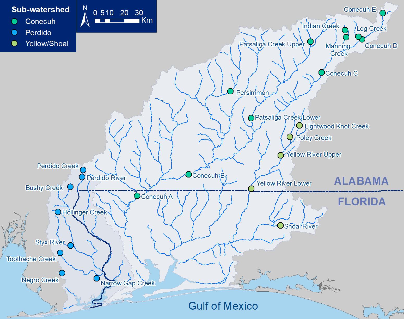 Map of Upper Watershed Monitoring Locations
Parameters measured: Water temperature, conductivity, dissolved oxygen, pH, Secchi depth, E. coli, chlorophyll-a, NO3+NO2, NH4, DIP, TKN, TP
The upper watersheds is mainly rural and forested that has not been sampled before, and this project collected baseline water quality information. More than half the sites sampled (16/24) had bacterial concentrations higher than the EPA threshold for healthy waters (E. coli: 410 MPN/100mL for a single sample OR 126 MPN/100 mL geometric mean). Additionally, some sites in the Perdido watershed had high nutrients and/or high algal biomass (chlorophyll-a). Results suggest more monitoring and source tracking is needed to identify where the pollutants are coming from to start managing these systems for high bacterial and nutrient loads.
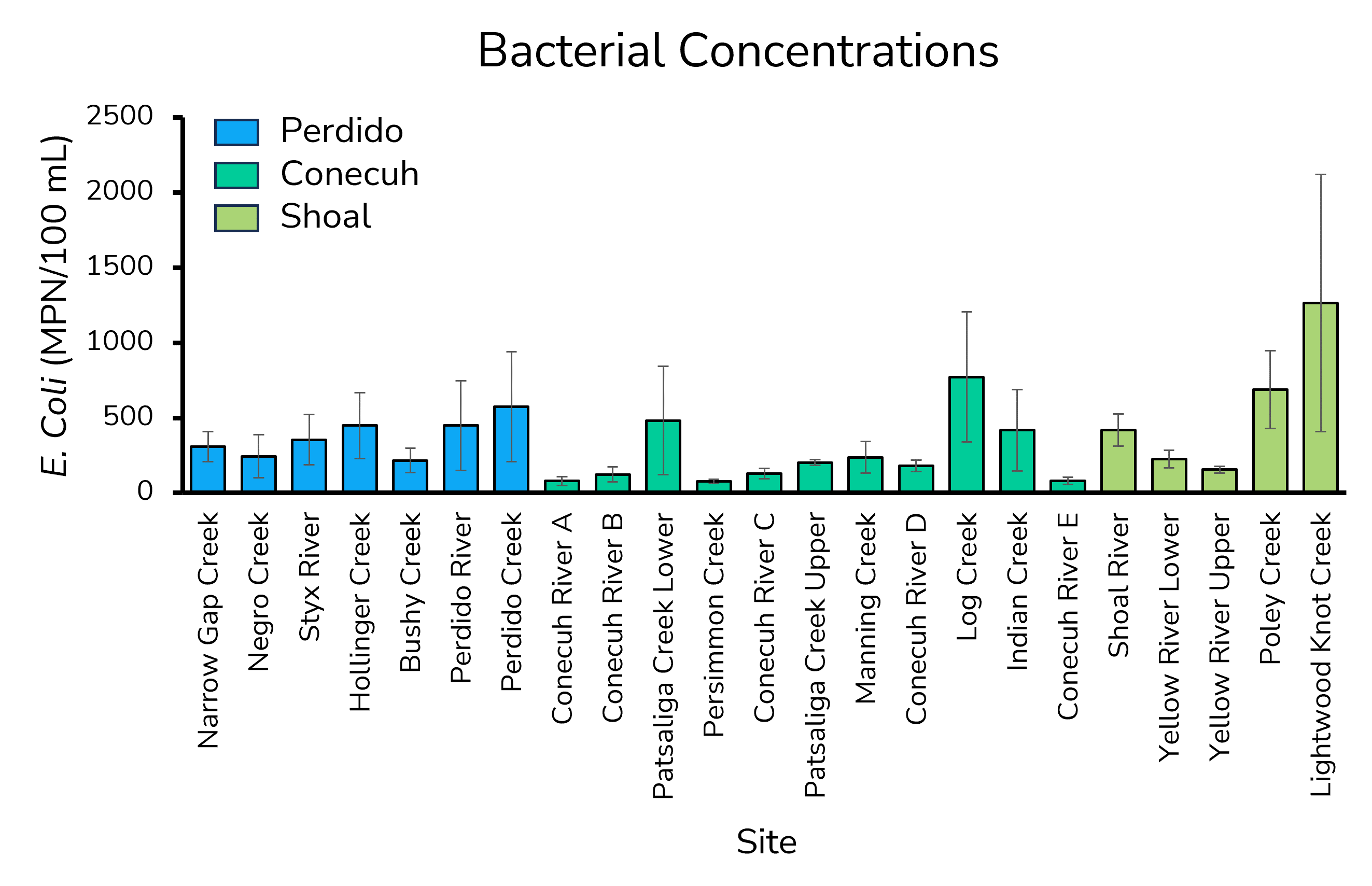
Key takeaways:
Due to concerns regarding local oyster die offs in the Pensacola Bay System and throughout the state of Florida, there has been an interest in and a need for more continuous data to track the changing conditions in salinity, temperature, and dissolved oxygen.
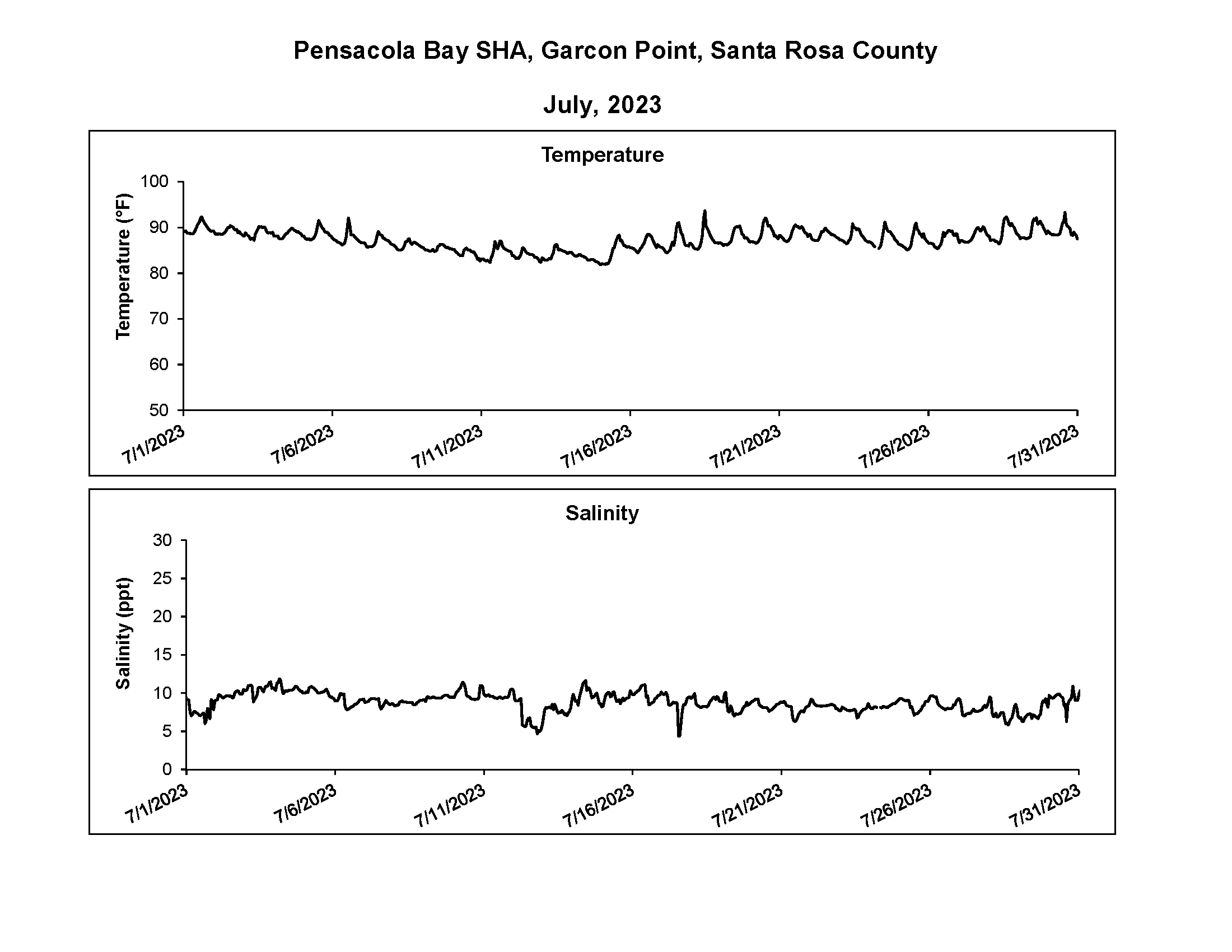
PPBEP partnered with Brandon Smith (Grayson Bay Oyster Company) to monitor water quality at his farm to better understand potential environmental factors affecting oyster ecology and survival. PPBEP staff deployed four HOBO dissolved oxygen and conductivity/salinity/temperature loggers to measure surface and bottom conditions at two different locations at the farm. The loggers were deployed from June 23 – September 20 and were set to record every 15 minutes. In-situ field measurements (i.e., water temperature, salinity, conductivity, barometric pressure, pH, and dissolved oxygen) were also recorded pre and post logging events.
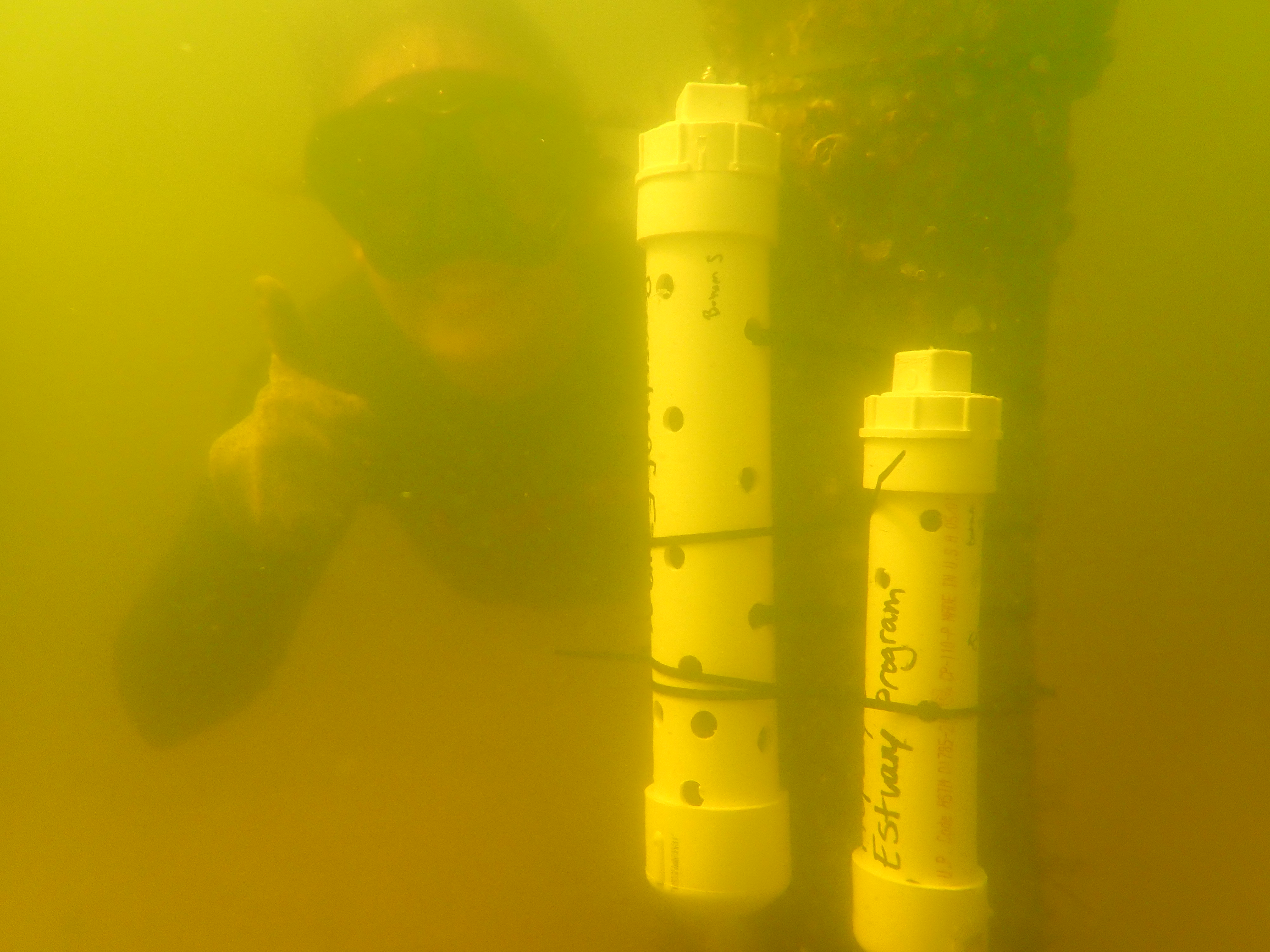 Researcher attaching water quality sondes to oyster cages
In addition to our monitoring efforts, researchers from the UF/IFAS Shellfish Program formed a network of growers across the state of Florida in 2023 to conduct monitoring at their farms to address challenges with oyster growth and mortality. Grayson Bay Oyster Co’s farm is one of 11 sites across the state. Water quality data collected as part of the Oyster Farms for Aquaculture Research and Monitoring of Shellfish Program (Oyster FARMS) can be viewed here.
Surface salinities dropped to single digits in early to mid-July due to widespread rainfall events and remained low for several weeks. Surface water temperatures increased to over 91°F and remained high throughout July and early August.
A combination of sustained low salinity and high surface water temperatures are known stressors to oysters. These data in combination with other critical information on oyster survival, spat settlement, and other related factors can inform future action to prevent future die offs and planning for future restoration efforts lead by PPBEP and its stakeholders.
These types of data and information can provide aquaculture operators and natural resource managers with information needed to make more informed decisions on protecting and restoring Pensacola Bay oysters.
The National Coastal Condition Assessment (NCCA) is a national standardized coastal monitoring program designed to estimate the condition of our Nation’s coastal environments every five years. The assessment is limited to the fringing, shallow band of coastal waters most heavily used by humans and most vulnerable to activities within adjacent coastal watersheds. The main goal of the NCCA is to answer two key questions about the quality of our waterways:
1) What percentage of the Nation’s coastal waters are in good, fair, and poor condition for key indicators of water quality, ecological health, and recreation?
2) What is the relative importance of key stressors such as nutrients and contaminated sediments?
This survey includes sampling of four categories of condition metrics including water quality, sediment quality, benthic community condition, and fish tissue contaminants. Consistent sampling techniques and procedures are followed so information can be shared across the country and over time.
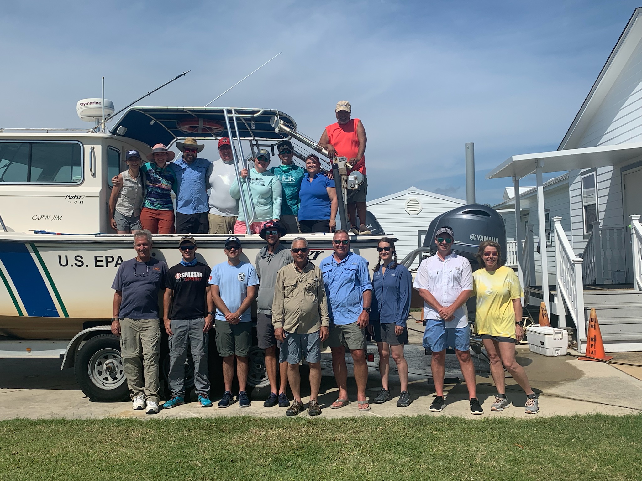
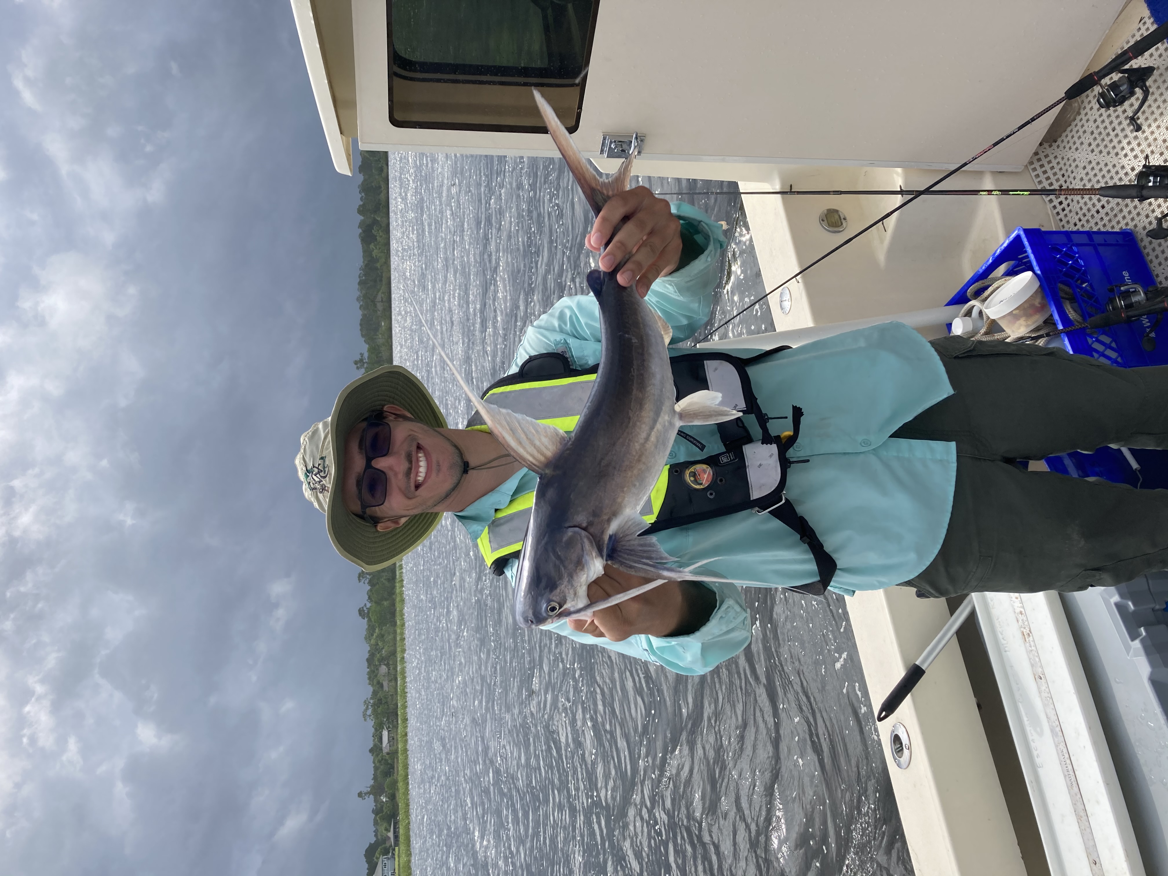
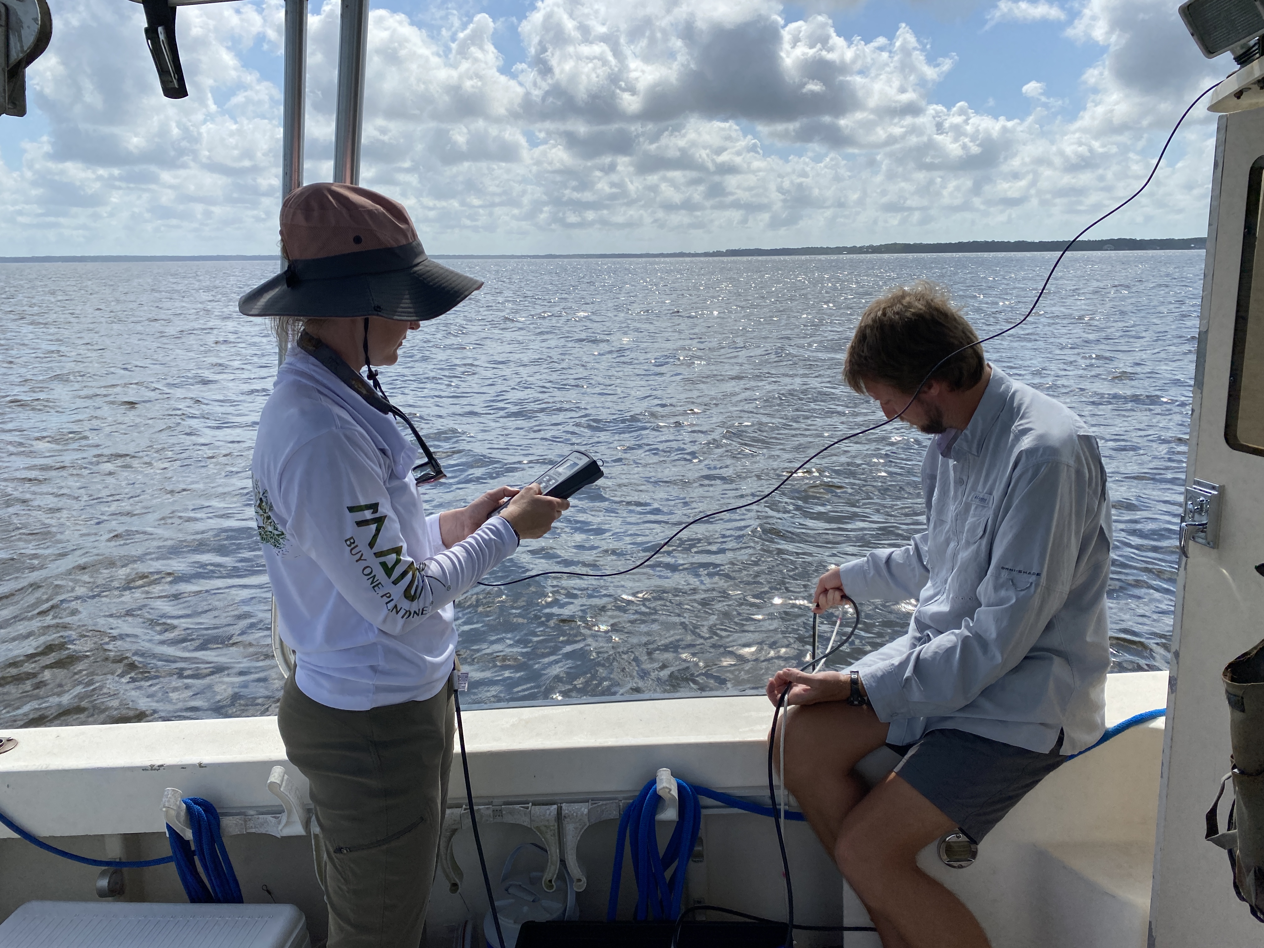
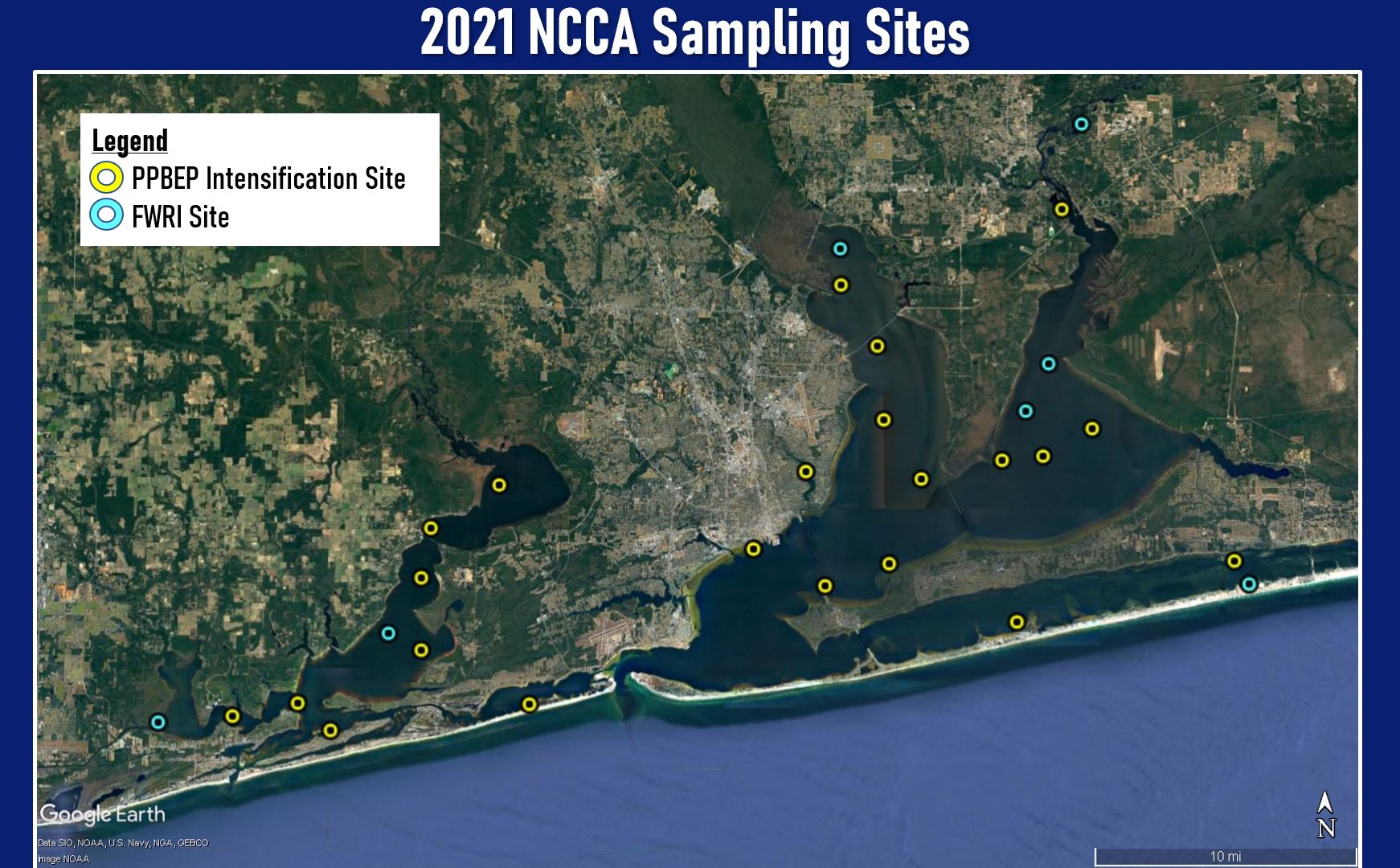
Our program partnered with the Environmental Protection Agency (EPA), Escambia County Water Quality and Land Management Division, the Florida Fish and Wildlife Conservation Commission (FWC), and other partners to participate in the NCCA for our two watersheds. The sampling was intended to occur during September 2020, but due to Hurricane Sally, the sampling was postponed to 2021. Originally, FWC's Fish and Wildlife Research Institute (FWRI) staff were only going to be able to sample a handful of sites. In response, PPBEP and EPA staff worked together to conduct an intensification by increasing the total number of survey sites for this year’s assessment for both Perdido and Pensacola Bay. This intensification allowed for more coverage of both bay systems, laying the foundation for the program’s State of the Bays Report and Comprehensive Monitoring Program.
For more information, visit https://www.epa.gov/national-aquatic-resource-surveys/ncca